No Photo
Property Record
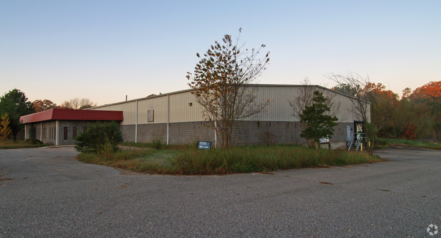
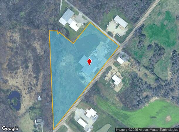
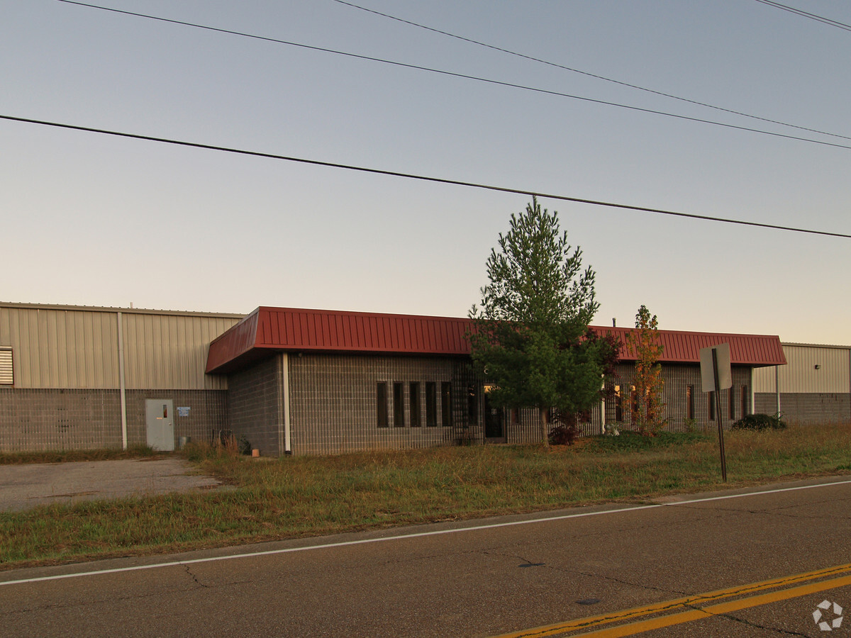
2035 Highway 70, Arlington, TN 38002
NEARBY LISTINGS FOR SALE OR LEASE
-
-
No Photo
-
View all Arlington listings for sale on LoopNet.com
Property Detail
2035 Highway 70
038-004.04
DISTRICT: 06, COUNTY AREA: B70
Commercialnec
Fayette
AE
Tennessee
47047C0155C
9.90 AC
2024
Fayette County
2024
Memphis
060300
Memphis, TN-MS-AR
29,350 SF
DEMOGRAPHICS near 2035 Highway 70
1 Mile
3 Mile
5 Mile
2024 Total Population
482
1,471
10,496
2029 Population
523
1,582
10,637
Pop Growth 2024-2029
+ 8.51%
+ 7.55%
+ 1.34%
Average Age
45
45
38
2024 Total Households
201
597
3,444
HH Growth 2024-2029
+ 7.96%
+ 6.87%
+ 1.48%
Median Household Inc
$66,000
$61,538
$100,452
Avg Household Size
2.20
2.30
3.00
2024 Avg HH Vehicles
2.00
2.00
2.00
Median Home Value
$246,808
$248,780
$341,778
Median Year Built
1988
1987
2003
Nearby Places
- Restaurants
- Banks
- Shops
- Fitness
- Groceries
PUBLIC TRANSPORTATION
AIRPORT
Memphis International
DRIVE
WALK
Distance
Memphis International
48 min
35.7 mi
Freight Ports
Port of Shreveport
DRIVE
WALK
Distance
Port of Shreveport
440 min
403.0 mi
Nearby Properties
Address
Land Use
TOTAL SIZE
Lot Size
Zoning
Address
Land Use
TOTAL SIZE
Lot Size
Zoning
270,500 SF
19.72 AC
I
Address
Land Use
TOTAL SIZE
Lot Size
Zoning
54,568 SF
13.93 AC
Address
Land Use
TOTAL SIZE
Lot Size
Zoning
35,611 SF
3.33 AC
Address
Land Use
TOTAL SIZE
Lot Size
Zoning
71,403 SF
5 AC
GC
Address
Land Use
TOTAL SIZE
Lot Size
Zoning
24,903 SF
2.35 AC
Address
Land Use
TOTAL SIZE
Lot Size
Zoning
5,876 SF
2.45 AC
NC
Address
Land Use
TOTAL SIZE
Lot Size
Zoning
7,786 SF
2.53 AC
Address
Land Use
TOTAL SIZE
Lot Size
Zoning
19,504 SF
5 AC
I
Address
Land Use
TOTAL SIZE
Lot Size
Zoning
5,001 SF
1 AC
Address
Land Use
TOTAL SIZE
Lot Size
Zoning
276.27 AC
CA
Address
Land Use
TOTAL SIZE
Lot Size
Zoning
7,300 SF
1 AC
GC
Address
Land Use
TOTAL SIZE
Lot Size
Zoning
18,993 SF
3.95 AC
GC
Address
Land Use
TOTAL SIZE
Lot Size
Zoning
7,172 SF
5.10 AC
Address
Land Use
TOTAL SIZE
Lot Size
Zoning
26,510 SF
5.54 AC
Address
Land Use
TOTAL SIZE
Lot Size
Zoning
5,000 SF
2.88 AC
GC
Address
Land Use
TOTAL SIZE
Lot Size
Zoning
334.79 AC
CA
Address
Land Use
TOTAL SIZE
Lot Size
Zoning
13,980 SF
5 AC
I
Address
Land Use
TOTAL SIZE
Lot Size
Zoning
7,957 SF
228.82 AC
Address
Land Use
TOTAL SIZE
Lot Size
Zoning
32,090 SF
5 AC
Address
Land Use
TOTAL SIZE
Lot Size
Zoning
7,400 SF
5.44 AC
I
Address
Land Use
TOTAL SIZE
Lot Size
Zoning
8,661 SF
35.87 AC
Address
Land Use
TOTAL SIZE
Lot Size
Zoning
24,800 SF
4.54 AC
I
Address
Land Use
TOTAL SIZE
Lot Size
Zoning
15,000 SF
2.69 AC
I
Address
Land Use
TOTAL SIZE
Lot Size
Zoning
5,620 SF
1.40 AC
Address
Land Use
TOTAL SIZE
Lot Size
Zoning
4,968 SF
2.60 AC
Address
Land Use
TOTAL SIZE
Lot Size
Zoning
15,200 SF
2.66 AC
I
Address
Land Use
TOTAL SIZE
Lot Size
Zoning
3,560 SF
2.20 AC
Address
Land Use
TOTAL SIZE
Lot Size
Zoning
9,025 SF
1.73 AC
GC
Address
Land Use
TOTAL SIZE
Lot Size
Zoning
8,353 SF
139.24 AC
The World's #1 Commercial Real Estate Marketplace
Connect with us
© 2025 CoStar Group
The information above has been obtained from sources believed reliable. While we do not doubt its accuracy we have not verified it and make no guarantee, warranty or representation about it. It is your responsibility to independently confirm its accuracy and completeness. Any projections, opinions, assumptions, or estimates used are for example only and do not represent the current or future performance of the property. The value of this transaction to you depends on tax and other factors which should be evaluated by your tax, financial, and legal advisors. You and your advisors should conduct a careful, independent investigation of the property to determine to your satisfaction the suitability of the property for your needs.